Services for the Agriculture Sector using Remote Sensing and Satellite and Drone Images: Leveraging remote sensing technologies, satellite imagery, and drone images to provide valuable services to the agriculture sector. These services encompass a range of applications, including crop monitoring, precision agriculture, yield prediction, pest and disease detection, irrigation management, and land use planning.
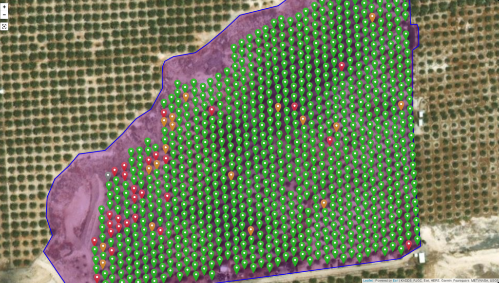
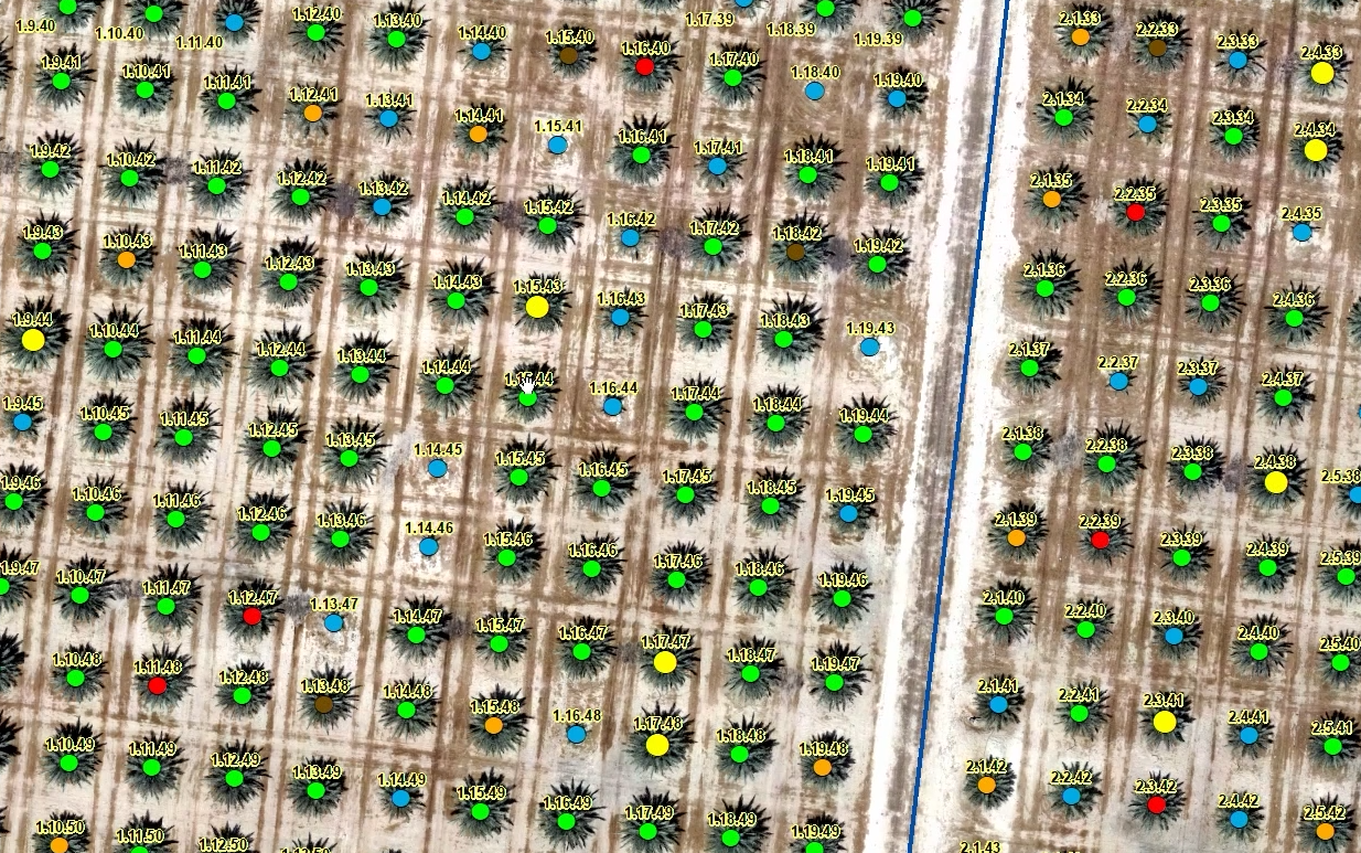
By utilizing remote sensing data, such as satellite images and aerial drone imagery, farmers and agricultural stakeholders can gain valuable insights into the health and condition of crops. These technologies enable the identification of variations in vegetation growth, detection of nutrient deficiencies, early detection of pests and diseases, and mapping of irrigation needs.
The services offered leverage the power of remote sensing and image analysis techniques to provide accurate and timely information to farmers. This information aids in making informed decisions about resource allocation, optimizing crop management practices, reducing input costs, and increasing overall productivity.
Through satellite and drone images, we can monitor large areas of farmland, assess crop health and vigor, and identify specific areas that require attention. The data obtained from these technologies, when combined with advanced analytics and machine learning algorithms, can provide customized recommendations tailored to individual farms and crops.
Furthermore, these services enable precision agriculture practices, where inputs such as water, fertilizers, and pesticides are applied precisely where and when they are needed. This optimization minimizes waste, reduces environmental impact, and improves overall efficiency and sustainability in agricultural operations.
Overall, services for the agriculture sector using remote sensing and satellite and drone images empower farmers with actionable information, enhancing their decision-making capabilities and enabling them to achieve better crop yields, reduce risks, and ensure sustainable agricultural practices.